


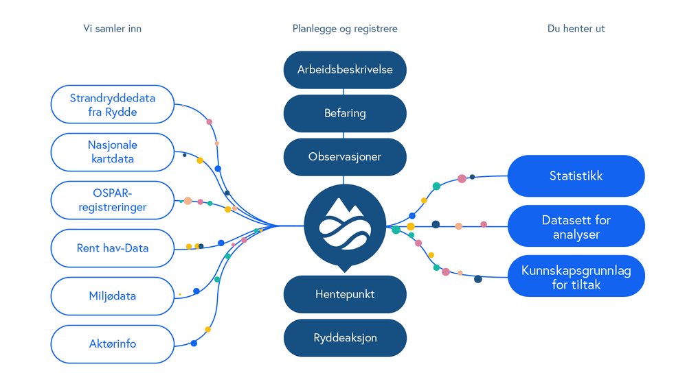
Rent hav collects the data you need in your work against marine litter.
Rent hav presents data from clean-up operations registered in Rydde and all data registered in Rent hav. This data is shown in the thematic maps and the datasets can be sorted and downloaded. You can find the datasets in the thematic layers, indicated using a table icon.
The map also includes a selection of public maps that are shown in thematic layers relating to nature and the environment, aquaculture, cultural heritage and public transport, as well as a good selection of background maps.
Rent hav also displays map data from other participants relating to clean-up operations and the extent of marine litter.
The data collected in Rent hav provides you with an overview for use in your work against marine litter.